Post by Steve on Feb 14, 2008 0:38:10 GMT -5
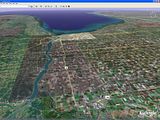
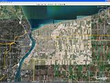
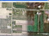
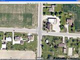
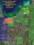
I've been a big fan of Google Earth for over two years now. For those who've yet to discover it, Google Earth is software that allows the user to view any location on Earth from above, at any height and at any angle. It features a combination of aerial photography and satellite imagery and the user can also choose to turn on (or off) a wide range of "layers", which will overlay such things as roads, borders, points of interest, 3D structures, etc.
Now, Google Earth is not only great fun, it's also capable of revealing a very great deal of information about the world aournd us. Because it's world wide, you can visit places you might never be able to visit in person; want to visit the pyramids of Egypt? Just zip over and zoom in... But, this applies locally as well; on the ground, we're all limited to some extent to where we can travel. In part, this can be due to things like terrain considerations (plowed fields are hard to tromp through in March...), or maybe private property (not everyone wants you tromping through their fields...). Google Earth eliminates those limitations. In a place like Lambton County, with it's gridwork of roads, the spaces between these roads can be hard to access and resources like Google Earth, topographical maps and aerial imaging, in general, can help us see and explore areas we may not be able to visit in person.
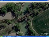
But, there's far more available and this is where I'd like to talk about Aerial Archaeology. What is it? Well, let's break it down. Merriam-Webster defines archaeology as "the study of the material remains of past human life and activities". So, "aerial archaeology" just means performing that study from the air, or more accurately, from above (for a bit more detailed definition, read this). Doing so allows us to see things from a perspective that we don't have while viewing from ground level. How? Well, here's an excerpt from an "Introduction to Aerial Archaeology" at the University of Vienna's Aerial Archive:
Before I bring this down to our local level and see what we can do with it, I first need to introduce you to another powerful tool available online; Toporama is Natural Resources Canada's topographic map server (read more about it here). Here you can view 'topo' maps of all of Canada, right down to quite detailed 1:50 000 scale. When used in conjunction with imaging sources like Google Earth, you have a very powerful combination of tools for discovering and studying Lambton County from above.
In my next post, I'll demonstrate the power of aerial archaeology by showing you an example of actual research that's dear to my heart: finding the route of an abandoned railway...
In the meantime, why not download Google Earth* and familiarize yourself with Toporama, so you can follow along with my example and maybe find something I missed...
* Google Earth can take a lot of computer power to run smoothly. Be sure to check the minimum requirements needed to run it and if your computer doesn't meet them, you can always use Google Maps instead. Just type in the location you want and then switch to the Satellite view, which uses the same images as Google Earth, but without all the extra navigation and layer features.
Now, Google Earth is not only great fun, it's also capable of revealing a very great deal of information about the world aournd us. Because it's world wide, you can visit places you might never be able to visit in person; want to visit the pyramids of Egypt? Just zip over and zoom in... But, this applies locally as well; on the ground, we're all limited to some extent to where we can travel. In part, this can be due to things like terrain considerations (plowed fields are hard to tromp through in March...), or maybe private property (not everyone wants you tromping through their fields...). Google Earth eliminates those limitations. In a place like Lambton County, with it's gridwork of roads, the spaces between these roads can be hard to access and resources like Google Earth, topographical maps and aerial imaging, in general, can help us see and explore areas we may not be able to visit in person.
But, there's far more available and this is where I'd like to talk about Aerial Archaeology. What is it? Well, let's break it down. Merriam-Webster defines archaeology as "the study of the material remains of past human life and activities". So, "aerial archaeology" just means performing that study from the air, or more accurately, from above (for a bit more detailed definition, read this). Doing so allows us to see things from a perspective that we don't have while viewing from ground level. How? Well, here's an excerpt from an "Introduction to Aerial Archaeology" at the University of Vienna's Aerial Archive:
The terms "aerial" or "remotely sensed information" already indicate, how aerial archaeology works: it uses the distant view. Archaeological sites show up on the ground surface, depending on their state of preservation, by light-shadow-contrasts (shadow marks), tonal differences in the soil (soil marks) or differences in height and color of the cultivated cereal (crop marks). In that way, settlements, graveyards, fortifications etc. produce specific structures, that can be identified easier from a high viewpoint.As you can see, aerial archaeology has been around for a long time, but it's the advent of the Internet and tools like Google Earth that's made it accessible to the general public and allows us amateur enthusiasts to join in the fun and perform our own research...
In principle, you could see an archaeological feature also while standing on it, but like a cat on the carpet, you would not be able to realize any pattern, that could give you a bit more information about WHAT this site could be like. If You choose a more distant viewpoint (even if it´s only a ladder or a building), the structures become clearer to you and the pattern becomes understandable.
Before I bring this down to our local level and see what we can do with it, I first need to introduce you to another powerful tool available online; Toporama is Natural Resources Canada's topographic map server (read more about it here). Here you can view 'topo' maps of all of Canada, right down to quite detailed 1:50 000 scale. When used in conjunction with imaging sources like Google Earth, you have a very powerful combination of tools for discovering and studying Lambton County from above.
In my next post, I'll demonstrate the power of aerial archaeology by showing you an example of actual research that's dear to my heart: finding the route of an abandoned railway...
In the meantime, why not download Google Earth* and familiarize yourself with Toporama, so you can follow along with my example and maybe find something I missed...
* Google Earth can take a lot of computer power to run smoothly. Be sure to check the minimum requirements needed to run it and if your computer doesn't meet them, you can always use Google Maps instead. Just type in the location you want and then switch to the Satellite view, which uses the same images as Google Earth, but without all the extra navigation and layer features.

