|
|
Post by Steve on Jan 20, 2011 0:12:29 GMT -5
Ok, I accidentally deleted Jeremy's original post on the Elarton Tramway. So, here's the original article and text he posted on it and my reply is below... Sorry Jeremy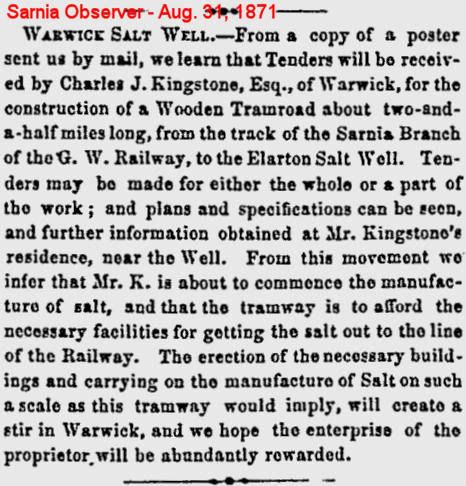 Here is an announcement from the Sarnia Observer for 31 August 1871 regarding the construction of a wooden tramroad, 2.5 miles long, from the Elarton Salt Well in Warwick to the Sarnia Branch of the Great Western Railroad. Apparently at this time they had not actually begun the production of salt (note that it is refered to as Elarton Salt Well, not Works). and my reply to the above post:I have that one in my collection... Thanks for posting! Have you ever been out to see what remains of the salt works and tramway? Not much, but it's still possible to detect that it was there.
|
|
jeremy
Junior Member

Posts: 50
|
Post by jeremy on Jan 20, 2011 22:34:54 GMT -5
I've seen the site of the Elarton Salt Works on Google Maps, zoomed in to point blank range, but no, I've never been out to visit. Might make part of a fun "Lost Lambton Tour"! The Elarton Salt Works Tramway (aka the Kingstone Tram Road) ran down the east side of Kingscourt from the Salt Works at London Line to the Great Western Railway just over a couple of miles away. It is clearly shown on the attached map of a portion of Warwick Township. Attachments:
|
|
jeremy
Junior Member
Posts: 50
|
Post by jeremy on Feb 12, 2011 18:56:00 GMT -5
I had come across a number of references to railway related events occurring on the Kingscourt Branch, and at first assumed that this meant that there was regular service of some sort on the Elarton Salt Works Tramway. However, it turned out that this only referred to the branch of the Grand Trunk between Alvinston and Kingscourt. It certainly seems to have been around in 1921, as this image extracted from Putnam's Handy Volume Atlas of the World suggests. The map also still shows the tramway running north from Kingscourt to the salt works. Attachments:
|
|
jeremy
Junior Member
Posts: 50
|
Post by jeremy on Feb 12, 2011 19:10:36 GMT -5
I am not sure of the original provenance of this map, but I found it in Christina Burr's paper "“Oil Mania”: Colonial Land Policy, Land Speculation, and Settlement in Enniskillen Township, 1830s–1860s" where it appears (unattributed) as Figure 1. I include it not because in adds anything new about the Elarton Salt Works, but because it shows the Tramway, and indeed the Kingscourt branch of the GTRR, in the wrong location! The place names are somewhat unclear, but the two tracks intersect with the main line several miles *west* of Kingscourt Junction! Attachments:
|
|
|
|
Post by Steve on Feb 16, 2011 18:46:56 GMT -5
I had come across a number of references to railway related events occurring on the Kingscourt Branch, and at first assumed that this meant that there was regular service of some sort on the Elarton Salt Works Tramway. However, it turned out that this only referred to the branch of the Grand Trunk between Alvinston and Kingscourt. It certainly seems to have been around in 1921, as this image extracted from Putnam's Handy Volume Atlas of the World suggests. The map also still shows the tramway running north from Kingscourt to the salt works. There wouldn't have been any regular service on the Elarton tramway that I'm aware of. It was just a narrow gauge, wooden tramway hauled by horses, or mules and used to haul salt from the wells on the London Road. Maps often show the tramway joining to the Great Western like a spur line, but this wasn't possible, of course. More likely, it ran up parallel to a siding on the GWR and there may have been some sort of overhead hoist to load railcars with the bags or barrels of salt. I doubt that loose salt was hauled in hopper cars. As for whether the tramway was still in operation in 1921, I'm not sure. If wouldn't be the first time that a map was printed with outdated data from older maps. We'll have to try and find out how long the tramway existed. |
|
|
|
Post by Steve on Feb 16, 2011 18:53:33 GMT -5
I am not sure of the original provenance of this map, but I found it in Christina Burr's paper "“Oil Mania”: Colonial Land Policy, Land Speculation, and Settlement in Enniskillen Township, 1830s–1860s" where it appears (unattributed) as Figure 1. I include it not because in adds anything new about the Elarton Salt Works, but because it shows the Tramway, and indeed the Kingscourt branch of the GTRR, in the wrong location! The place names are somewhat unclear, but the two tracks intersect with the main line several miles *west* of Kingscourt Junction! This map is an old electoral riding map of Lambton from the early 1900s (1920s I believe...). That's why you see "W." (Lambton West) and "E." (Lambton East) superimposed on the map. I've come across this map several times, but rarely in its original context. I don't think it was ever meant to be strictly physically accurate, but just to show the riding boundaries. Notice how "Bothwell" (the name of that riding) is superimposed over the southern tier of Lambton's townships? |
|


